
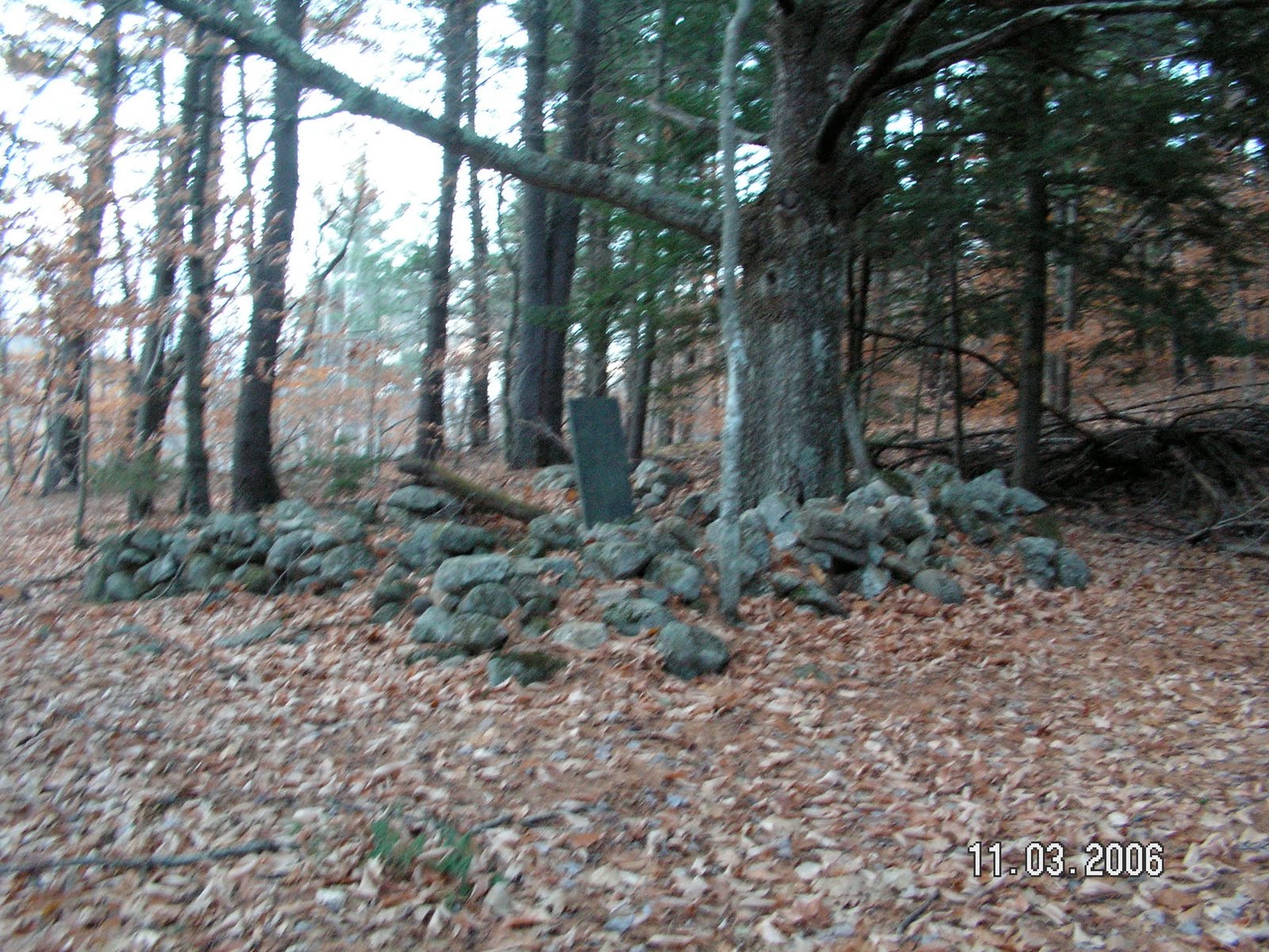
It’s a lonely grave. Most are of course, but this one is all by itself on a wooded hillside. A stone wall surrounds the gravestone and an old oak tree. You can tell the tree grew there when the hillside was a pasture. Massive limbs came out its trunk horizontally before heading skyward because sunlight was available all the way around for most of the tree’s life. Now, however, the sky is crowded with branches of taller white pines that choke out sunlight. Whoever made the cemetery likely planted the oak tree. Most of its limbs are dead now and the tree won’t live much longer.
 The gravestone shows a weeping willow etched on top of the dark, gray slate and one can still read the words clearly unlike inscriptions on the more popular marble stones which have disintegrated with acid rain over the years. It reads:
OLIVE W.
wife of Jacob Stiles
died August, 1848
AE 51 yrs 7m
Around the little cemetery beautifully-made, double stone walls snake over and around the steep forested knolls on what’s left of the old farm where Olive lived. Someone obviously took pride in their construction because they’ve held up well for more than a century and a half, but the cemetery enclosure is falling apart. I doubt it was built by the same person(s?) who made the others.
Down the wooded hillside and across an old road is a cellar hole. I assume it once held up the Stiles house, but I can’t be certain because roads on the old maps don’t always agree with what I could see on the ground, and I know why. There was a big wind in early December, 1980 that blew down a lot of timber in the area which is now mostly National Forest. The federal government built a new road through its holdings (which now include the old Stiles place) to salvage what timber it could. The government road doesn’t always follow the older roads on my maps.
The Stiles place was abandoned, probably after 1850 I’m guessing, and nobody hayed the hillside anymore. White pines and hardwoods took it over. The 1858 Stoneham Map is badly smudged in this area of Stoneham close to the Lovell town line near Horseshoe Pond and the nearest discernible house was then owned by someone named Stanley. There’s another home owned by someone named Gray further in toward the Stow town line. Both were gone on the 1880 map which shows fewer homes in that vicinity.
However, an eyewitness account was supplied to me by Lovell Historical Society’s Cathy Stone whose uncle, Arthur Stone, visited Olive Stiles’s grave in 1890 and again in the late 1930s. Stone describes the Stiles place as a cellar hole at “the end of the road.” In 1890, he’d hiked a road leading from near where Cold Brook goes into Kezar Lake westward toward Horseshoe Pond. The road is still discernible but not passable for vehicles of any kind. It comes out perpendicular to another road going from Joe McKeen Hill in Lovell northward over the Stoneham line to the new government road mentioned above where there’s a locked gate today. Stone said it was pasture all along this route in his day and still being grazed by cattle. It’s all woods now, however.
“Here on a rocky hillside farm . . . Jacob Stiles had lived and raised his family of eleven children” he wrote. “. . . . The Stiles farm stretched from the mountain top [Styles Mountain on the USGS map] down to the shores of Horseshoe Pond. . . . and Jacob Stiles doubtless named [the pond]. . . . About a half mile further out in the pasture there was a square lot enclosed on all four sides by a stone wall [containing] a slate grave stone . . .”
Remember, Stone was writing probably just before 1940 about both an 1890 trip and the more recent one: “Fifty years ago a small oak sapling was the only vegetation within the enclosure except the wild flowers that covered the ground. . . . Today, the oak sapling is a sturdy tree but otherwise nothing is changed.” Stone, also, called the grave lonely and “high on a hillside looking out over the pond and over miles of woodland to where in the south a low blue mountain wall stopped the vision.”
That view is gone in the 21st century, and can only be imagined. It must have been stunning. The 1941 USGS map confirms the area was still pasture.
Stone seems to have obtained information about the Stiles family from locals between his first visit and his second. “Olive was the second wife of Jacob . . . [she] brought up the first wife’s brood,” he wrote. Imagine stepping into that situation? Raising eleven children on the last farm at the end of the road in this remote corner of Maine? Olive Stiles must have been quite a woman.
“She undoubtedly won the affection of her [eleven] stepchildren,” wrote Stone. “The grave proves it. During her life she used to walk out along the cart path to the pasture and look out over the pond. Perhaps she and Jacob used to go out there in the long summer evenings after the chores were done. She thought the place was beautiful and told her family that when she died she hoped she could be buried there.” Stone suggested her stepsons built the stone wall around the grave. and that would fit with my observation. They didn’t build walls as well as their father did.
Stone owned a cabin on Horseshoe Pond and could look across toward the hillside pastures of the old Stiles farm. He dreamed of taking a moonlight stroll up there to sit near the grave in case Olive had something she wanted to whisper to him. We don’t know if she ever did, but perhaps she and Stone have communicated in some other place and time.
No comments:
Post a Comment